A new Tropical Storm Zeta could be on the way as it forms beside Cayman Islands
From Cayman National Weather Service:
A broad area of low pressure just southwest of Grand Cayman is expected to support cloudy rainy conditions and isolated thunderstorms across the area for the next 24 hours. Showers are expected to be heavy at times. A flood warning is in effect for the Cayman Islands
The latest from the NHC as at 800 am EDT says:
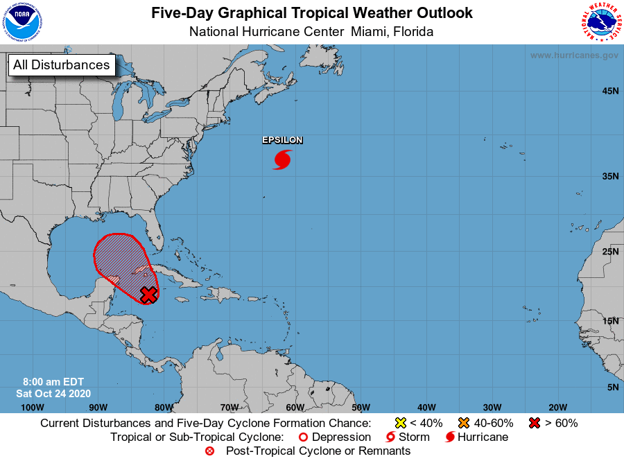
Satellite, radar and surface data indicate that a broad area of low pressure located just southwest of Grand Cayman Island is gradually becoming better organized, with a better defined wind circulation,
increasing thunderstorm activity and falling surface pressures since yesterday.
Environmental conditions are conducive for further development, and a tropical depression is expected to form within the next day or so while the low drifts toward the north and northwest.
The system could move near western Cuba on Monday and move slowly across the southeastern Gulf of Mexico by Tuesday.
Interests in western Cuba, the Florida Keys, and the Yucatan Peninsula should monitor the progress of this disturbance.
A NOAA Hurricane Hunter reconnaissance aircraft is scheduled to investigate the disturbance this afternoon. Regardless of development, locally heavy rainfall will be possible over portions of the Cayman Islands, Jamaica and Cuba through early next week.
* Formation chance through 48 hours…high…90 percent.
* Formation chance through 5 days…high…90 percent.
Michael Cappucci writes in The Washington Post:
An area of thunderstorms is slowly gaining in organization over the balmy waters of the Caribbean, with increasing odds that it could develop into a tropical depression or tropical storm. If it does intensify into a tropical storm, it would be named Zeta.
The National Hurricane Center bumped its chances of development up to 70 percent of becoming a tropical depression, a precursor to a tropical storm, during the next few days. This is a sudden leap from the 20 percent odds advertised on Thursday. However, because of the system’s lack of organization, weather models are still struggling to get a grasp on it, making for a challenging, low-confidence forecast.
Air Force Reserve Hurricane Hunters were dispatched to fly into and investigate the system Friday afternoon, which may give models a better idea of where this storm could be headed.
If the disturbance does get a name, though, which appears increasingly likely, it would tie with 2005 for the greatest number of named storms to ever occur in a hurricane season. Any storms beyond that would bring us deeper into the Greek alphabet than we’ve ever gone before.
Shortly after lunchtime on Friday, heavy showers and thunderstorms were affecting the southern coast of Cuba and western Jamaica. The system’s center of circulation was located about 100 miles south of the Cayman Islands.AD
The Cayman Islands’ weather agency warned of “possible flooding of low lying areas” with heavy downpours bubbling up across the island.
On infrared satellite imagery, a pinwheel of showers and thunderstorms could be seen slowly orbiting about a common center. The system appeared rather balanced, meaning that thunderstorm activity was present all around the low-level center. This could help it to organize a central vortex and jump-start the process of intensification.
The system has exhibited healthy outflow of air aloft, which is suggestive of a strengthening storm. Outflow is essentially the “exhaust” of a tropical weather system, such as a hurricane. The more efficiently it can evacuate spent air up out of and away from it, the easier it is for the storm to pump in moisture-rich air at the surface and intensify.
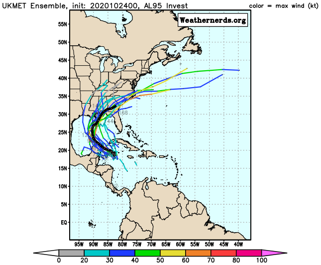
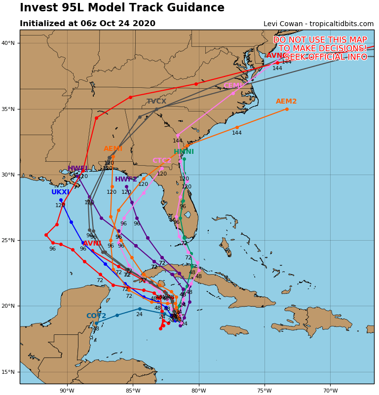
The jury is out when it comes to the computer models and whether Invest 95L will end up intensifying. The models, however, have struggled to even “keep up” with real-time observations, forcing forecasters to rely more on experience.
To read more on this story and to see the many graphics click HERE