Two areas to watch in the Atlantic for the formation of a Tropical Depression or Storm
From Weather.Com
At a Glance
- There are two areas to watch for possible tropical development this week.
- These two areas could eventually become threats to parts of the Caribbean.
- It’s still too soon to determine if either of them will threaten the mainland U.S.
- It’s not uncommon for there to be multiple areas to watch for tropical development in late August.
The Atlantic hurricane season has already had an active start and this week there are two areas to watch for possible tropical development.
In the past week, we’ve seen tropical storms Josephine and Kyle form in the Atlantic. Both of those systems have now dissipated and neither of them brought significant impacts to any land areas.
Now, we turn our attention to a couple of new disturbances the National Hurricane Center (NHC) is tracking for possible formation into the next tropical depression or storm.
Two Areas to Watch
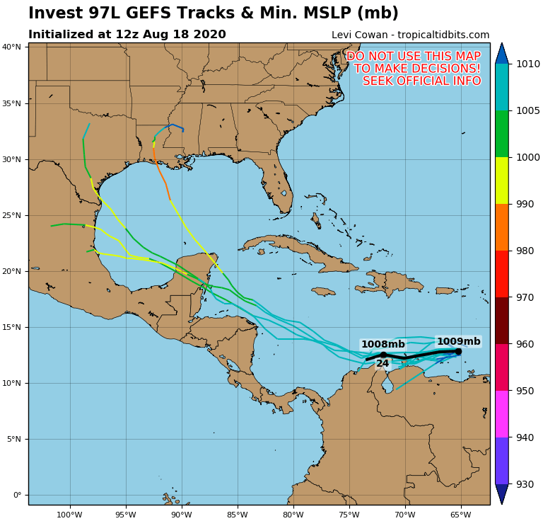
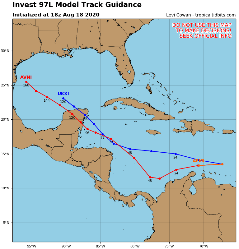
System 1
The first system, dubbed Invest 97L, is tracking through the eastern Caribbean Sea. Its fast movement should prevent tropical development in the near-term future.
(MORE: What an Invest means)
This system will be watched a bit more closely once it reaches the western Caribbean during the second half of this week. A slower movement and more favorable upper-level winds might give it a chance to slowly organize into a tropical depression by that time.
For now, the NHC has given this system a high chance of developing into a tropical depression during the next five days.
This system could bring at least some rainfall to the Yucatan Peninsula by this weekend. It’s too early to know if it will bring any impacts to other land areas beyond that time, including the mainland United States.
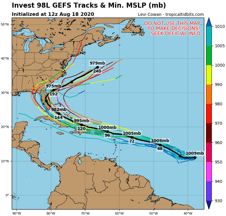
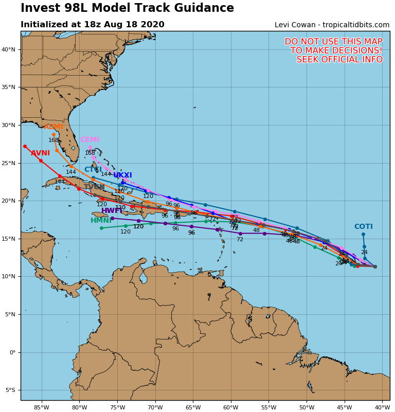
System 2
A broad area of low pressure located about halfway between Africa and the Lesser Antilles is also being tracked by the NHC.
This system, which is known as Invest 98L, has been given a high chance to form into a tropical depression or storm during the next couple of days as it tracks toward the west-northwest.
Rainfall and gusty winds from this system could reach parts of the eastern Caribbean, including Puerto Rico and the Virgin Islands, by Friday or this weekend.
It’s too soon to know what, if any, impacts this system might bring to other parts of the Caribbean or the mainland United States. If this system did eventually impact the mainland United States it would not be until sometime next week.

Laura and Marco will be the names given to the next two tropical storms that form in the Atlantic
Tracking Multiple Disturbances Not Unusual in Late August
It’s not unusual to be tracking multiple disturbances in the Atlantic for tropical development this time of year. Some of these disturbances form into tropical storms and hurricanes, but many others do not.
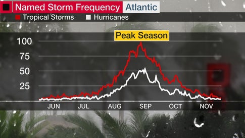
Tropical activity usually increases in the Atlantic by late August as oceanic and atmospheric conditions become most favorable for hurricane development. The peak activity occurs around Sept. 10.
But climatology isn’t the only factor that favors an active period.
A hemispheric-scale wave of increased moisture and lift called the Madden-Julian Oscillation (MJO) is moving eastward through the Pacific Ocean. When the increased moisture and lift reaches a tropical ocean basin, the chance of getting a tropical depression or storm is increased for a week or so.
(MORE: What Is the Madden-Julian Oscillation?)
In the heart of hurricane season, this MJO wave can also lead to tropical cyclone outbreaks as the wave passes. Tropical cyclone outbreaks are quick bursts of activity consisting of three or more tropical depressions or storms in a week or two in one basin.
This MJO wave is expected to have its peak influence on the Atlantic in the final 10 days of the month before moving out of the Atlantic sometime in early September.
It is far too early to know where storms could form, or how many will form in this period, but we all should be prepared, especially going into the peak of hurricane season.
The Weather Company’s primary journalistic mission is to report on breaking weather news, the environment and the importance of science to our lives. This story does not necessarily represent the position of our parent company, IBM.
For more on this story go to: WEATHER.COM


