

Caribbean News Events iCommunity iEnvironment iLocal News iScience iTech iWorld News News Publisher's Choice Weather
Hurricane Watches for central Gulf Coast as TS Gordon intensifies
By Bob Henson From Weather Underground Tropical Storm Gordon formed on Monday morning in the waters of the Upper Florida Keys, and it will be making a fast trek toward the upper Gulf Coast by late Tuesday. As of 11…
UPDATED: TD forms in the Atlantic – Now TS Beryl
From National Hurricane Center Tropical Storm Beryl Discussion Number 2 NWS National Hurricane Center Miami FL AL022018 500 PM AST Thu Jul 05 2018 Beryl has been a bit of a surprise today, which is not uncommon for tiny tropical…
Hurricane Watch for SE Florida ahead of powerhouse Irma
By Bob Henson From Weather Underground A hurricane watch and a storm surge watch are up for Florida, from the Florida Keys to Jupiter Inlet, as Category 5 Hurricane Irma heads steadily west-northwest at 16 mph. Hurricane Irma delivered a…
Powerful hurricane Irma bears down on Caribbean
From Newsmax Hurricane Irma, a record Category 5 storm, churned across the Atlantic on Tuesday on a collision course with Puerto Rico and the Virgin Islands, threatening to lash the northern Caribbean with a potentially devastating mix of fierce winds,…
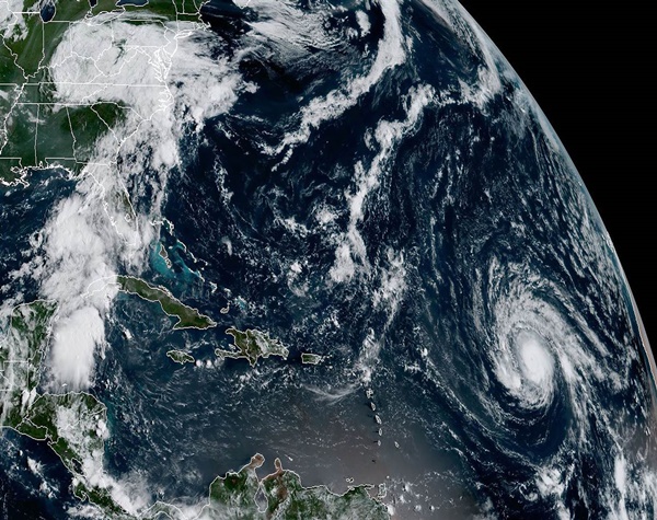
Hurricane Matthew reorganizing over the Bahamas; major shift in long-range track
By: Jeff Masters , From Weather Underground Hurricane Matthew was a weakened a Category 3 hurricane with 115 mph winds on Wednesday morning at 8 am EDT, thanks to the disruptions to the storm caused by landfalls in Haiti and…
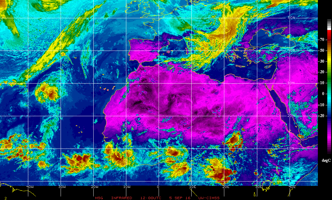
Catastrophe looming in the Caribbean
From Higgins Storm Chasing A worst case scenario is playing out for Major Hurricane Matthew in the Caribbean which has many distinguished weather observers very concerned across the globe. Above: Latest rainbow satellite imagery via NOAA Major Hurricane Matthew (Category…
Matthew dumping extreme rains; threat to southeast U.S. growing
By: Jeff Masters and Bob Henson , 6From Weather Underground Very dangerous Hurricane Matthew is maintaining Category 4 strength as it heads northwards at 6 mph, and is already dumping potentially catastrophic rains on Haiti and the Dominican Republic. An…
Little change to 92L [Should reach Cayman Islands Wed/Thu]
By Dr Jeff Masters From Weather Underground Satellite images on Monday morning showed that the moderate level of heavy thunderstorm activity associated with a large tropical wave passing through the Lesser Antilles Islands (Invest 92L) had changed little since Sunday….
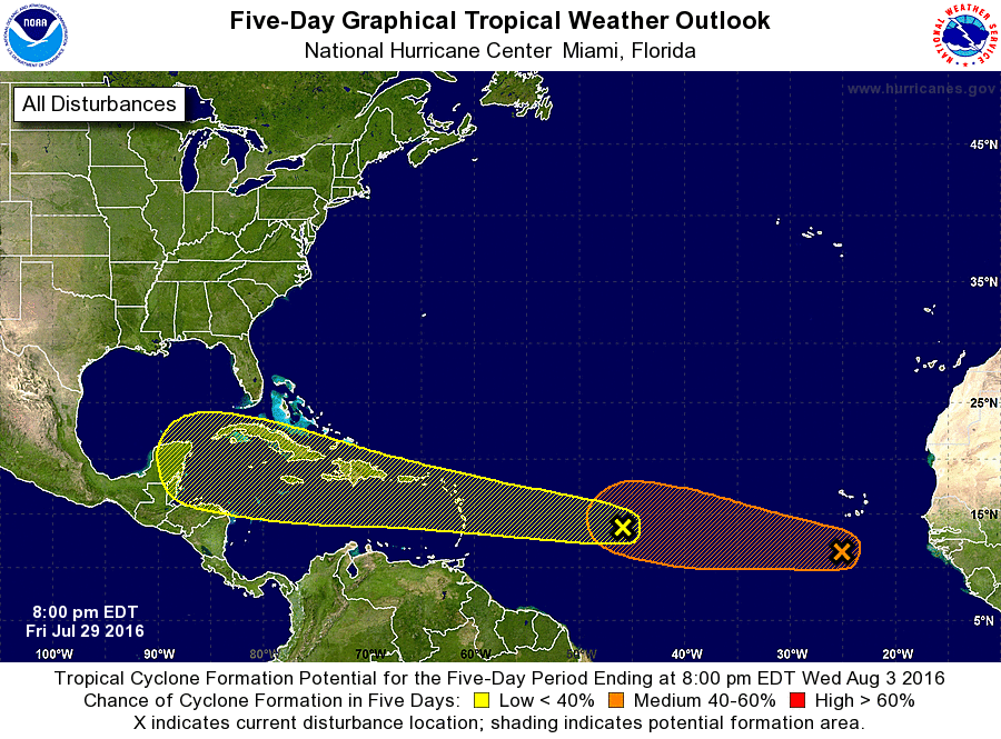
Further Updated: Twin Invests 96L and 97L Worth Watching in the Atlantic
By: Jeff Masters , 2:41 PM GMT on July 29, 2016 There’s a new threat area to discuss today in the Atlantic: a tropical wave midway between the Lesser Antilles Islands and the Cabo Verde Islands that is headed west…
iNews Briefs & Community Events (From BIG FISH 95.5)
Express approval exchange agreement between Cayman Islands and former Netherlands Antilles Islands From Curacao Chronicle THE HAGUE, WILLEMSTAD – The Dutch House of Representatives wants the approval of the treaty between the Netherlands, on behalf of the former islands of…


