Cayman: Aerial Survey Enhances Geospatial Understanding
The Ministry of District Administration and Lands is pleased to announce the completion and release of the updated Aerial Photography layer for the Cayman Islands in 2023. The project, overseen by Chief Surveyor-Darren Kelly, was executed by the Department of Lands and Survey, utilizing state-of-the-art technology to capture Orthomosaic aerial imagery.
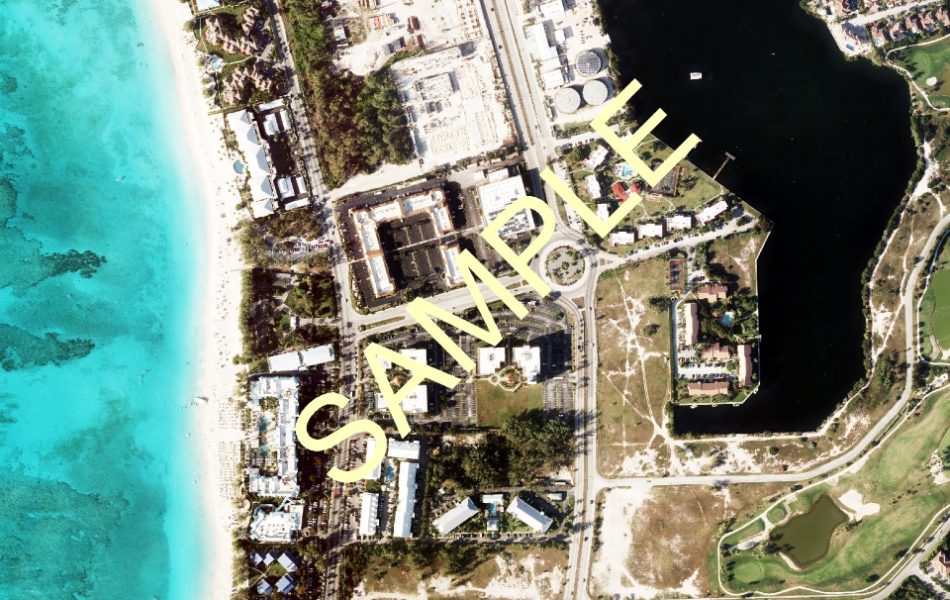
The national ‘Aerial Photography’ layer, is a critical record of the Department of Lands and Survey, and has been updated every four years for over two decades. This invaluable imagery serves as a crucial tool for various government departments, including the Department of Environment (DOE), Department of Planning, National Roads Authority (NRA), and more. It is extensively used for development planning, environmental monitoring, coastline changes, boundary dispute resolution, court cases, and accident reconstruction.

Darren Kelly, Chief Surveyor; Dom Mellor, Airborne Sensor Operator; Dylan Till, Pilot; Uche Obie, Director of Lands & Survey in front Twin-engine Beech E-90 Aircraft used to conduct Aerial Survey
The last update of this scale was conducted in April 2018, making the 2023 Aerial Survey a significant milestone. The project involved the acquisition of imagery in February 2023, including topographic data such as buildings and roads.
Commenting on the completion of the project, Chief Surveyor Darren Kelly stated, “The Aerial Survey 2023 is instrumental in providing accurate and up-to-date geospatial information for various sectors. It not only documents changes to the landscape over the past four years but also supports informed decision-making for a sustainable future.”
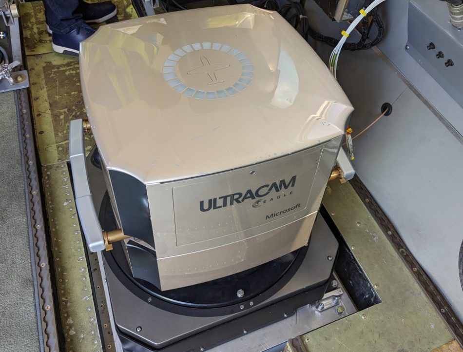
Vexcel UltraCam Eagle M3 camera used to capture high-resolution imagery – mounted in aircraft
Bluesky International Ltd., operating from a specialized fixed-wing aircraft, utilized the state-of-the-art Vexcel UltraCam Eagle M3 camera to capture high-resolution imagery.
Director of Lands and Survey, Uche Obi, emphasized the significance of the aerial photography, stating, “The completion and release of the 2023 aerial photography is critical to the Cayman Islands. This imagery, widely used by various sectors, provides valuable information to emergency services like 911, RCIPS, and the Fire Department. It also plays a vital role in government decision-making and contributes as a revenue source to the Lands and Survey’s geographical information system.”
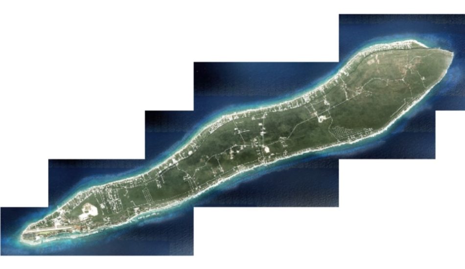
Cayman Brac Imagery Extents
Customers interested in purchasing images can do so via the map request page on the Cayman Land Info website, with prices varying based on map requests and subscriber packages.
For general information about Lands & Survey, visit: https://www.caymanlandinfo.ky/
For further assistance or enquiries, please contact Lands & Survey via email at [email protected].


