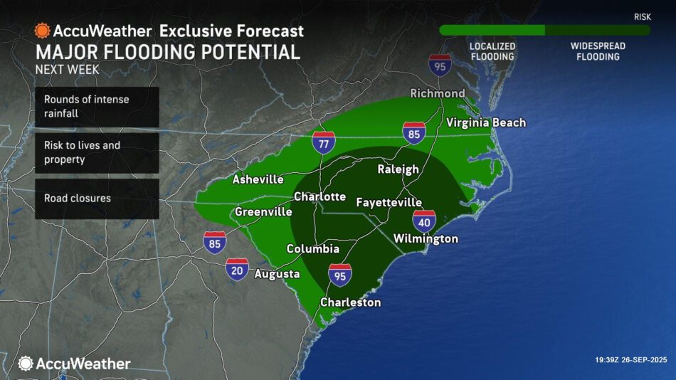
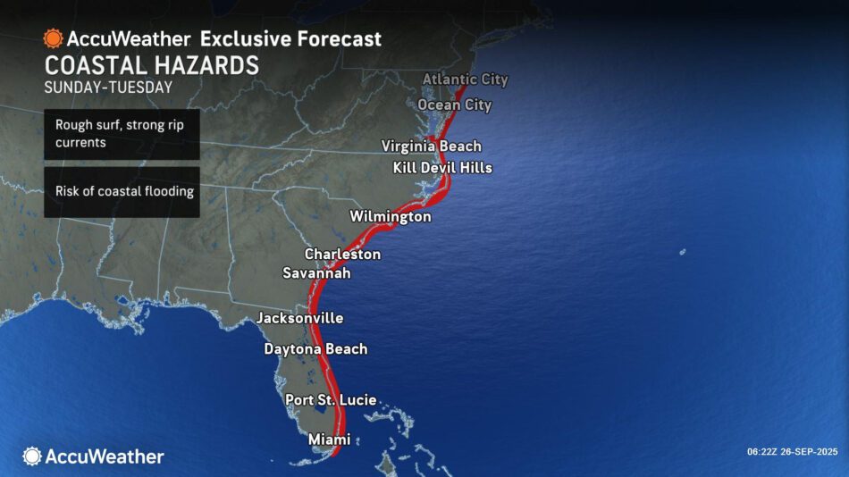
US: Widespread flash flood risk increasing in the Carolinas with more than a foot of rainfall possible
From AccuWeather Public Relations <
AccuWeather hurricane experts say there may be 8-16 inches of rainfall across parts of the Carolinas early next week, with an AccuWeather Local StormMax of 24 inches.
AccuWeather® Global Weather Center – Sept. 26, 2025 – AccuWeather® hurricane experts are warning the public and businesses about the growing threat of heavy rainfall and flash flooding from a storm that is expected to approach the Southeast U.S. coast early next week.
“There is an increasing risk of heavy and persistent rainfall over a long period of time across the Carolinas and parts of the Southeast. If this storm slows down or stalls out, there may be hours of torrential rainfall that could trigger widespread, life-threatening flash flooding. A foot or more of rainfall is not out of the question,” AccuWeather® Chief Meteorologist Jonathan Porter said. “If the storm turns out to sea or parallels the coastline, rainfall amounts and the flooding risk may be greatly reduced.”
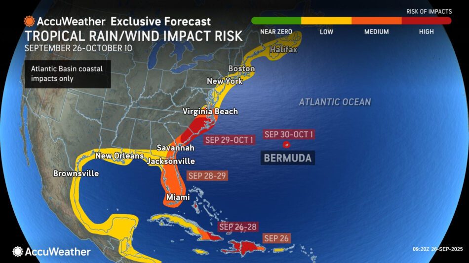
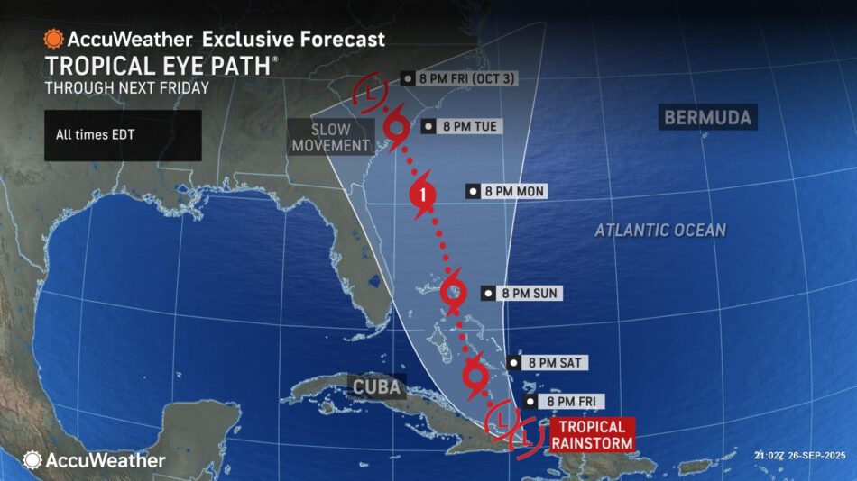
A tropical rainstorm moving north of Cuba Friday evening is expected to gradually gain wind intensity and become a tropical storm this weekend, bringing gusty winds and heavy rain to the Turks and Caicos as well as the Bahamas. The storm is forecast to intensify into a hurricane early next week. The next name on the list is Imelda.
AccuWeather uses the term “tropical rainstorm” to describe certain tropical systems that may bring significant impacts from rain or wind before they are officially classified as a tropical depression or storm in order to raise public awareness of their disruptive, damaging and dangerous potential.
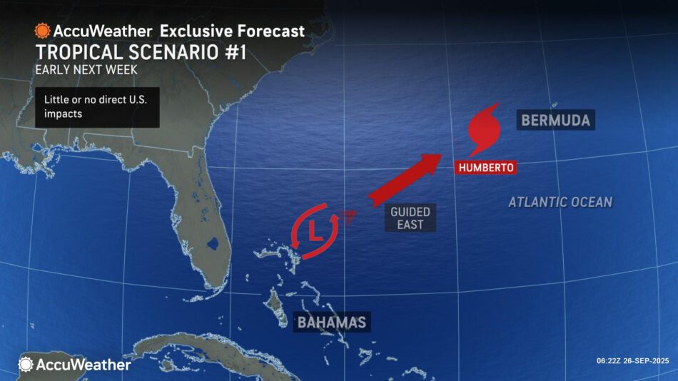
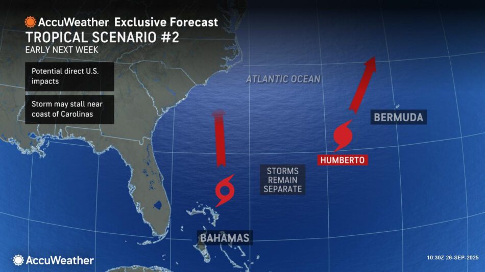
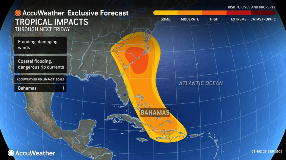
Several scenarios remain possible, ranging from a landfall along the southeastern U.S. coast to a northeast turn out to sea.
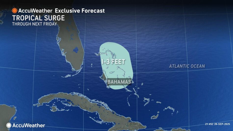
Regardless of a landfall, AccuWeather® hurricane experts expect a heavy rainfall threat that could lead to widespread flooding across portions of the southeastern U.S. early next week. Rough surf, rip currents and coastal flooding are also expected next week as the storm moves north. There may be a tornado threat north and east of the center of the storm.
“People who live and work near low-lying and flood-prone areas should be on alert and prepared to move to higher ground. Flash floods are incredibly dangerous, especially after dark. Please do not try to drive down a flooded road. You’re putting your own life and others at risk. Swift water rescues are incredibly dangerous and are often entirely preventable,” Porter said. “Now is the time to prepare and make sure your emergency supplies are stocked up and ready. We don’t want anyone to be caught off guard or to underestimate the risks. People across the Southeast should closely monitor AccuWeather forecast updates throughout the weekend.”
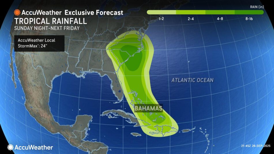
A widespread 2-4 inches of rainfall is expected from eastern Georgia to central Virginia. There can be 8-16 inches of rain from northeastern South Carolina to eastern North Carolina, with an AccuWeather Local StormMax™ of 24 inches. Rainfall of this magnitude can lead to widespread life-threatening flooding if the storm slows down or stalls.
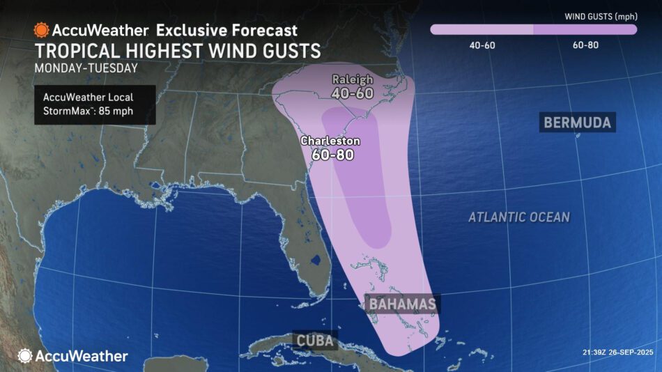
The wind field from this storm could grow in size significantly as it approaches the U.S. coastline. Wind gusts of 40-60 mph can occur from eastern Georgia to far southern Virginia. Stronger wind gusts of 60-80 mph can occur near where the storm approaches the coast and makes landfall, with an AccuWeather Local StormMax™ of 85 mph. These winds can be strong enough to cause power outages and localized structural damage.
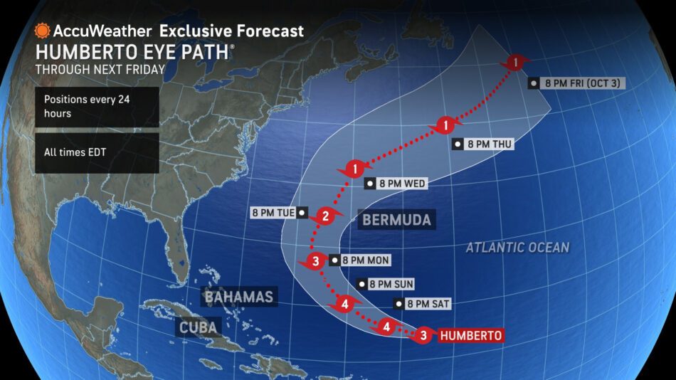
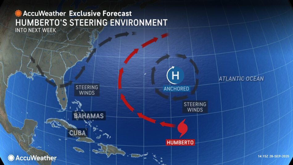
AccuWeather® hurricane experts say any interaction with Hurricane Humberto may impact the track and impacts from this emerging storm. Humberto has intensified into a major hurricane and is forecast to pass between Bermuda and the U.S. East Coast early next week.