New tropical storm forecast to develop in the Atlantic; high risk of a second storm forming near the Bahamas
From AccuWeather Public Relations
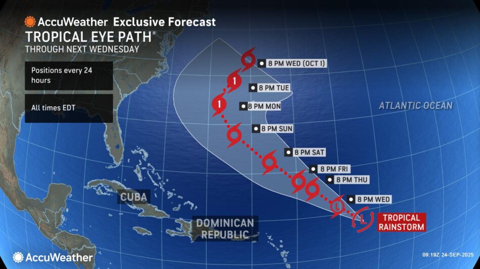
> AccuWeather® hurricane experts say a new tropical rainstorm in the Atlantic is expected to intensify into the next named tropical storm later this week as it moves northwest toward Bermuda
> A tropical wave advancing toward the Bahamas has a high risk of potential tropical development by the end of this weekend
> People along the U.S. East Coast, Bermuda and the Caribbean should monitor AccuWeather® forecast updates closely through the weekend
AccuWeather® Global Weather Center – Sept. 24, 2025 – AccuWeather® hurricane experts are closely monitoring a new tropical rainstorm that formed east of the Lesser Antilles, and another tropical wave moving toward the Bahamas that has a high risk of tropical development potential by the end of this weekend.
AccuWeather uses the term “tropical rainstorm” to describe certain tropical systems that may bring significant impacts from rain or wind before they are officially classified as a tropical depression or storm in order to raise public awareness of their disruptive, damaging and dangerous potential.
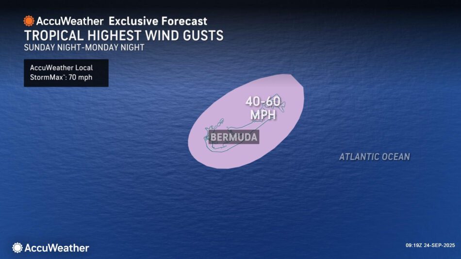
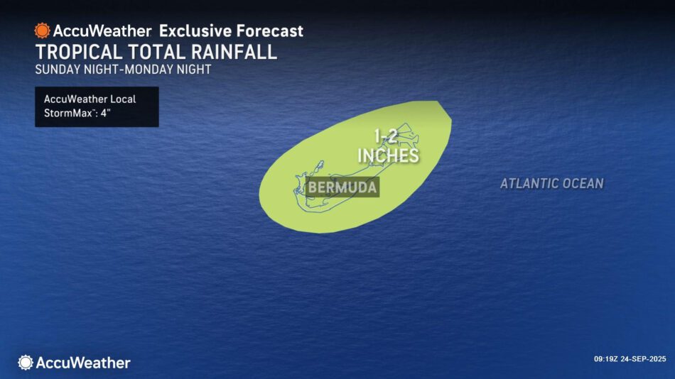
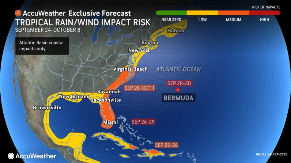
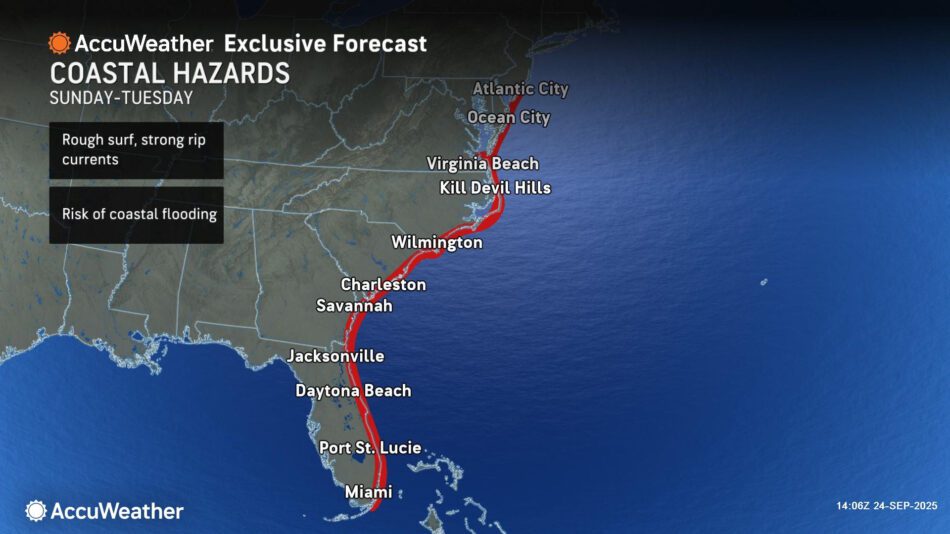
“AccuWeather has identified a new tropical rainstorm that formed in the Atlantic, several hundred miles east of the Leeward Islands. It is expected to gain wind intensity and organize into a tropical storm later this week as it moves to the northwest. It may intensify into a hurricane late this weekend or early next week. At this time, the storm is forecast to pass between Bermuda and the East Coast of the U.S. This storm may bring some rain and gusty winds to Bermuda starting Sunday evening,” AccuWeather® Lead Hurricane Expert Alex DaSilva said. “This storm will likely create rough surf and rip currents that could impact beaches across the Bahamas and the East Coast starting this weekend. People in Bermuda and along the East Coast should monitor forecast updates closely.”
Several hundred miles to the west of the tropical rainstorm, AccuWeather hurricane experts are tracking a tropical wave that may develop into a storm by the end of this weekend.
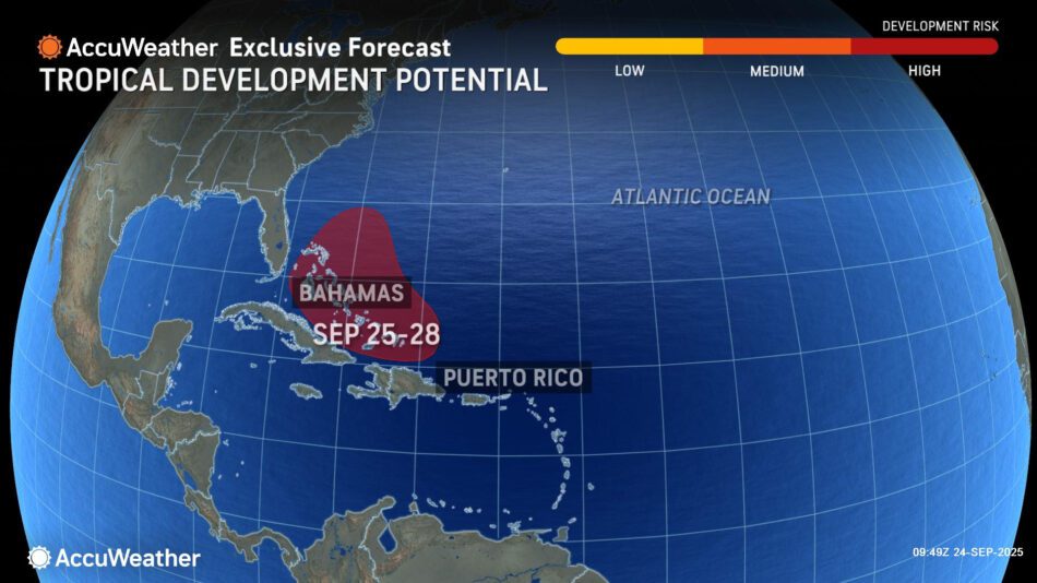
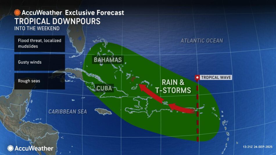
“AccuWeather is closely monitoring a tropical wave moving through the northeastern Caribbean that has a high risk of tropical development potential. This wave is forecast to move into an area with atmospheric conditions that are conducive to tropical development later this week,” DaSilva explained. “Regardless of tropical development, this wave will bring downpours and gusty winds to parts of the Virgin Islands, Puerto Rico and the Dominican Republic. People across the Caribbean and the U.S. East Coast should keep a close eye on forecast updates into the weekend. This storm may develop quickly.”
AccuWeather® hurricane experts say there is a medium risk of tropical rain or wind impacts from South Florida to Virginia Beach from Sunday through next Wednesday.
The next two names on the list of 2025 Atlantic hurricanes are Humbertoand Imelda.
“We predicted this burst of tropical activity in late September, after an unusually quiet stretch in the tropics during the climatological peak of the season. Hostile atmospheric conditions across much of the Atlantic basin prevented tropical waves from developing in late August and early September,” DaSilva said. “Disruptive wind shear and dry air have eased, allowing tropical waves to organize into storms. We will likely see Humberto and Imelda form before the end of the weekend.”
- Another tropical wave is located in the open Atlantic and is not expected to develop at this time. Additional tropical waves moving off Africa over the next several weeks will also have to be watched for possible development.
- AccuWeather® hurricane experts reduced the maximum number of named storms and hurricanes forecast to develop this year due to the unusual midseason lull.
- The AccuWeather® 2025 Atlantic Hurricane Season Forecast now predicts 13-16 named storms and six to nine hurricanes.
- It is important to note that the forecast for three to six direct impacts on the U.S. has not changed, despite a slight lowering of the total number of storms and hurricanes.