Gigantic Saharan Dust Cloud Barrels Toward Florida/Caribbean: Here’s What That Means
By Ingrid Vasquez From Yahoo News
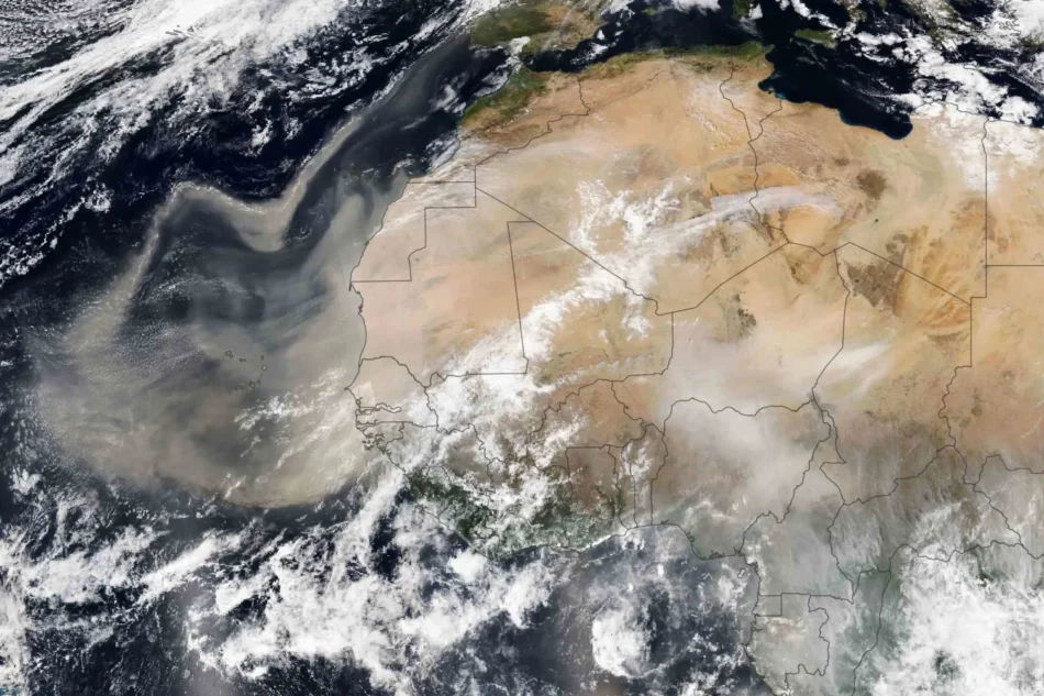
Lauren Dauphin, using VIIRS data from NASA EOSDIS LANCE, GIBS/Worldview Saharan Dust traveling
NEED TO KNOW
- A gigantic cloud of dust drifting from the Sahara Desert is expected to impact southern and central parts of Florida today [Wednesday]
- Its effects, including hazy skies, are likely to be seen until the weekend
- The dust cloud has already drifted into the Caribbean
Florida, along with some of its surrounding states, is in the path of a gigantic cloud of dust drifting from the Sahara Desert.
According to Scientific American, between late spring and early fall, dust from the Sahara Desert is blown out over the Atlantic Ocean every three to five days. When the conditions are right, the air masses, referred to as the Saharan Air Layer (SAL), filled with dust, make their way to North America.
The dust cloud has already drifted into the Caribbean. The National Weather Service for San Juan, Puerto Rico, stated on X that “peak concentrations” of the dust were expected to arrive midday on Monday, June 2.

The dust will impact southern and central parts of Florida from late Tuesday into early Wednesday, potentially causing residents to see hazy skies, especially during sunrise and sunset, until the weekend, ABC News affiliate WFTS-TV reported. The dust is also forecast to impact skies and reduce visibility across the Southeast, per Fox Weather.
“When you have Saharan dust or any other kind of particulate, if the sun is coming in at an angle, like during sunrise or sunset. It can hit those particulates that are close to the ground just right and result in those different, kind of orangey-reddish colors,” Ana Torres-Vazquez, a meteorologist at the National Weather Service’s Miami office, told Scientific American.
According to WFTS-TV meteorologist Greg Dee, Saharan dust is usually “not an issue for us here right at the surface, most of the dust is high up in the atmosphere.”
“But occasionally, some folks that are very sensitive to particles, particulates in the air, may experience a little bit of discomfort,” he said
As far as its environmental impact, WJXT reported that the Saharan Air Layer can suppress the development of tropical cyclones as well as cloud development and storms. This is due to its characteristics of “warm, dry air with strong winds.”
A plume of Saharan Dust will arrive across South Florida late this week, out ahead of a weak frontal boundary and moisture which will bring increasing rain chances this weekend.
A more concentrated plume of Saharan Dust is modeled to arrive across the region mid next week. pic.twitter.com/Bvw3AqYEtE— NWS Miami (@NWSMiami) May 28, 2025
Moist and dry air are expected to alternate between the Caribbean and as far north as Florida waters in the Gulf and Atlantic over the next 10 days, per Accuweather.
AccuWeather reported that it is monitoring an area along the Southeast coast for “potential subtropical or tropical development.”
“While the risk of development is low, impacts such as heavy, flooding rain that can disrupt outdoor plans, minor coastal flooding, rip currents and rough surf are all possible mid-to-late week,” its website states.
Read the original article on People
Our source: Yahoo News