Category 1 Hurricane Dorian expected to be a Cat 4 by Sunday
By Dr. Jeff Masters From Weather Underground Aug 29 2019 11:33 EDT

At 11 am EDT Thursday, Dorian was a Category 1 hurricane with 85 mph winds, headed northwest at 13 mph. A NOAA hurricane hunter aircraft measured a central pressure of 986 mb, a 5 mb drop from the 5 am value. Satellite images showed a compact, well-organized hurricane with decent low-level spiral banding and upper-level outflow, and a tiny 6-mile diameter eye. Dry air could be seen wrapping into the southeast side of Dorian, and this dry air was keeping the brakes on rapid intensification. An area of moderate wind shear appeared to be impinging on the southwest side of Dorian, helping limit intensification.

Dorian spares Puerto Rico; limited damage in the Virgin Islands
Dorian made landfall on St. Thomas in the U.S. Virgin Islands as a Category 1 hurricane with 75 mph winds at 2 pm EDT Wednesday. Winds on the south shore of Saint Thomas peaked at a sustained 72 mph between 1:17 and 1:27 pm EDT Wednesday, with gusts as high as 97 mph, when St. Thomas was in the developing northern eyewall of Dorian. As of early Thursday morning, there appears to be only limited damage in Saint Thomas, with no roofs lost, according to stthomassource.com. However, multiple boats were overturned or came loose from moorings and ran aground at the St. Thomas Yacht Club, and possibly at other marinas. There were extensive power outages and some road damage from flooding on the island. The greatest rainfall recorded at a WU Personal Weather Station (PWS) during Dorian was atISTTHOMA12 on St. Thomas, which had 5.70”.
WOW! #Dorian is hammering the #USVI & #BVI with wind gusts clocked to 97 MPH at 231′ at Estate Bovoni.
We’ve got the latest on the @weatherchannel#HurricaneDorian#weatherchannelpic.twitter.com/JHy8FrX6gf— Mike Seidel (@mikeseidel) August 28, 2019
The other islands in the U.S. and British Virgin Islands received lower winds and less rain from Dorian, with no reports of major damage. Thankfully, Dorian spared Puerto Rico. The island escaped seeing tropical storm-force winds, with the highest winds being 27 mph, gusting to 45 mph, on Culebra Island, off the northeast coast of mainland Puerto Rico. Heavy rains in excess of 4” were limited to a few areas in southwest Puerto Rico. Unfortunately, a man died after he fell off the roof of his home near San Juan while cleaning the gutters in preparation for the storm, according to WAPA-TV.

Intensity forecast for Dorian
Dorian is in a position to take advantage of atmospheric and oceanic conditions that will support several days of strengthening, and perhaps one or more rounds of rapid intensification. For the remainder of today, intensification will likely be limited by the inner-core structure of the hurricane identified by the Hurricane Hunters. This morning, Dorian had concentric eyewalls—a tiny inner one with a diameter of just 6 miles, surrounded by a larger outer eyewall of about 30 miles in diameter. Until Dorian consolidates around one of these eyewalls, significant intensification is unlikely.
Over the next three days, wind shear is expected to be light, less than 10 knots, and mid-level relative humidity will increase from around 55% to around 65%. What’s more, Dorian will be passing over very warm water, with sea surface temperatures of around 29-30°C (84-86°F), about 0.5°C (1.0°F) warmer than average.
Oceanic heat content will be above 50 kilojoules per square centimeter along much of Dorian’s path for the next three days, and above 75 kJ/sq cm much of Thursday. Values above 75 kJ/sq cm are closely associated with higher odds of rapid intensification.
The official NHC forecast calls for steady strengthening of Dorian, bringing it to Category 4 strength by Sunday morning with 130-mph winds. It is certainly possible that rapid intensification will occur before that point, which could quickly bring Dorian to major-hurricane strength. In fact, the Rapid Intensification Index in the 12Z Thursday run of the SHIPS and DTOPS models gave a 23% and 25% chance, respectively, of Dorian’s sustained winds increasing 30 mph by Friday morning, which would make it a Category 3 hurricane with 115 mph winds.
Expect Dorian to experience at least one eyewall replacement cycle (ERC) before any U.S. landfall. In fact, the hurricane may already have begun its first ERC on Thursday morning, given the concentric eyewall structure found by the Hurricane Hunters. These cycles can produce a dip in strength lasting a day or so, as the inner eyewall collapses and is replaced by the outer eyewall, but they also tend to enlarge a hurricane. Between this possible effect and the tendency of hurricanes to expand over time and with latitude, we can expect Dorian to be considerably larger at landfall than it is now, with a larger wind field.
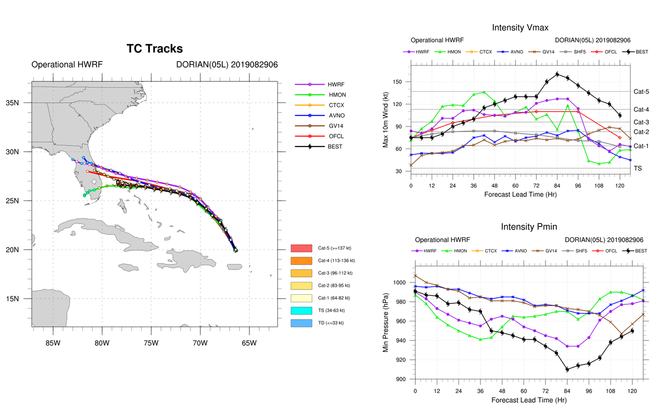
Apart from the potential for short-term rapid strengthening, some models are pushing Dorian’s strength to very dangerous levels on its approach to Florida this weekend. Among our top intensity models, the 6Z Thursday runs of the HWRF, COAMPS, and HMON models had Dorian making landfall as a Category 4 storm with 135 – 140 mph winds, the 6Z LGEM and DSHIPS models expected a Category 3 landfall with 120 mph winds, and the GFS model called for a Category 2 landfall with 95 mph winds.
Bottom line: expect Dorian to undergo a round of rapid intensification by Friday, which will bring it to at least Category 3 strength as it approaches the Southeast U.S. coast on this weekend.
Track forecast for Dorian
Over the next day, Dorian should continue on a fairly steady northwest course. Forecast models have been consistently projecting that Dorian will make a turn toward the west-northwest on Friday, as it feels the steering effects of a westward extension of the Bermuda high and a weak upper low to its southwest. Models then keep Dorian heading west or west-northwest toward the Southeast U.S. coast, with a landfall in central Florida on Monday the most likely scenario at present.
The first major track question is how soon the anticipated left turn takes place and how sharp it is. Once Dorian is heading west or west-northwest, we should have a more confident sense of the latitude where it might reach Florida.
The second question is how strong the ridge is to Dorian’s north. The 0Z Thursday ensembles from the European and GFS models indicate that a weakness may develop in the ridge that could allow Dorian to slow or stall and embark on a slow northward motion early next week. It’s too soon to know whether such a turn will happen, much less whether it would occur while Dorian is offshore, near the coast, or onshore. Overall, the European ensemble leans toward a turn closer to the East Coast, while the GFS favors a more delayed northward turn. The models have trended slower with today’s set of runs, and Dorian may be moving at just 5 mph when it makes landfall in Florida. Any slowing or stalling will greatly increase the risk of flooding, especially north of Dorian’s track.
It also remains possible that Dorian will cross the entire peninsula and go on to pose a threat to the northern Gulf Coast, an outcome favored by about two-thirds of the GFS ensemble and about a third of the Euro ensemble, as well as the 12Z Thursday run of the UKMET model.
Last nights 00z #ECMWF ensemble track guidance for #Hurricane #Dorian continues to show large along track uncertainty (related to differences in forward speed).
This becomes critical after 120h; The ridge steering it west is now fcast to weaken & may cause it to bend N after. pic.twitter.com/daNK27CB9R— Philippe Papin (@pppapin) August 29, 2019
The 0Z Thursday runs of our top operational track models give a sense of the divergent outcomes still possible:
–The GFS shows a landfall in northern Florida on Sunday night, with Dorian then heading slowly north-northwest and stalling over Georgia. (The 06Z and 12Z runs are similar, but with landfall more toward central Florida.)
–The European model depicts a landfall between Miami and Palm Beach on Monday, with Dorian then tracking up the heart of the peninsula and hugging the coast of Georgia and South Carolina by midweek.
–The UKMET shows Dorian dipping west-southwest just before landfall, crossing the coast between Miami and Palm Beach on Monday and then heading north across the eastern peninsula.
It would not be a shock to see some north-versus-south “windshield wiper” back-and-forthing on these landfall projections for another day or so, until Dorian undergoes the expected westward bend in its track. Now is an excellent time to keep in mind that the average 5-day track error over the past five years of NHC forecasts is around 200 miles. With this in mind, the entire Southeast U.S. coast—especially from South Florida to South Carolina—needs to stay abreast of Dorian’s evolution. People along the northern Gulf Coast should also be aware that there is a chance of a Gulf Coast landfall from Dorian next week.

Major flooding to begin Thursday night on Southeast U.S. coast
In a case of very bad timing, Hurricane Dorian’s push toward the Southeast U.S. will coincide with some of the highest astronomical tides of the year—locally known as king tides. These tides will extend for several days after the new moon that arrives on Friday. So-called “nuisance” flooding from high astronomical tides has become an increasing headache along the U.S. coast. The upward trend will continue as human-produced climate change continues to bump up sea levels. (See our post on a major 2018 NOAA report finding that the Southeast U.S. coast can expect flood conditions from 26 to 85 times a year as soon as the 2040s.)
The extension of the Bermuda high that will build and steer Dorian westward this weekend is already pushing onshore flow against the Southeast coast. At Savannah, Georgia, and Charleston, South Carolina, major flooding is expected with the evening high tide on both Thursday and Friday night. The predicted peaks for Thursday night are 8.2’ at the Charleston Harbor tidal gauge and 10.1’ at the Fort Pulaski, GA, tidal gauge. The current forecast shows slightly lower evening tides on Saturday, but there’s a good chance that swells from Dorian (not yet reflected in the forecast) will be pushing up water levels by that point. Enhanced tidal flooding is likely to extend further south along the Florida coast by this weekend, depending on Dorian’s exact track.
Here’s what can be expected from the currently projected levels of flooding Thursday night, well before any direct impacts from Dorian:
Charleston: At 8.0 ft above Mean Lower Low Water (MLLW), major coastal flooding occurs. Widespread flooding occurs in Downtown Charleston with numerous roads flooded and impassable and some impact to structures. Impacts become more extensive all along the southeast South Carolina coast including erosion at area beaches, with limited or no access to docks, piers, and some islands.
Savannah: At 10.0 ft MLLW, major coastal flooding occurs. HW-80 between Savannah and Tybee Island will become impassable, isolating Tybee Island. Around Savannah, flooding could impact 5th Ave, 10th St, 14th St, and the intersection of 6th St and Lewis Ave. Flooding will also occur on Wilmington Island, the Coffee Bluff community, and Burnside Island. Roads also become impassable on Ossabaw Island and Sapelo Island including Landing Rd near Meridian. Also, HW-17 south of Darien could flood and become impassable.
Bob Henson co-wrote this post.
For more on this story go to: https://www.wunderground.com/cat6/Category-1-Hurricane-Dorian-Expected-be-Cat-4-Sunday?cm_ven=cat6-widget


