25 Dec Weather in Cayman
25 Dec Tue 2018
Weather in Cayman
SYNOPSIS
Moderate to fresh northeasterly winds and rough seas will continue across the Cayman area for the next 24 hours as a high pressure system strengthens over the southeastern US. Radar images show showers mainly around Grand Cayman moving towards the west southwest.
Humidity: 80% (DOWN from yesterday)
UV: 7.2 HIGH (UP from yesterday) Temperature: Today’s current temperature – See weather forecast top right of website. Yesterday: H 83.0°F L 75.6°F
Wind direction TODAY: ENE 15-25 mph GC Wind direction TONIGHT: ENE 10-20 mph
Barometer: 1016.00 mb Steady Rain: Last month: 2.88 in Last 24 hrs 0.03 This month: 2.28 in 0 days since rain 12 rain days in December
2017 Season Total: 62.94 in 2018 Season Total: 43.74 in
Average Yearly Rainfall 56.20 in (Note: National Weather Service 2017 Season Total – measured at Owen Roberts Airport GT – was 59.32 in)
All readings are from SOUTH SOUND.
Average rainfall in December 2.2 in. Average temperature in December: 73°F to 84°F
Sea Temperature in December: 82°F
MOON: 89% illumination

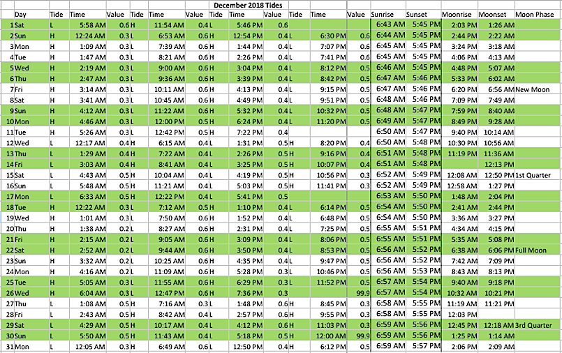
TIDES, SUNRISE, SUNSET, MOON RISE, MOON SET AND MOON PHASE
GRAND CAYMAN December 2018 – Click to enlarge
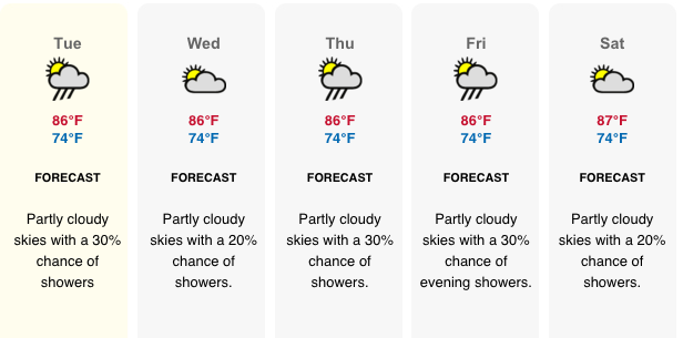
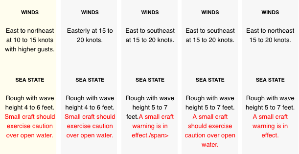
LOCAL 5 DAY FORECAST
FOR RADAR IMAGE GO TO: http://www.weather.gov.ky/portal/page/portal/nwshome/forecasthome/radar
Also see Weather In Cayman: http://www.weatherincayman.com/
Moon info and graphic:
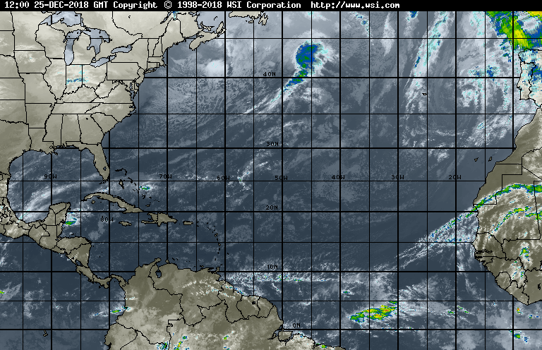
Atlantic satellite image: http://www.intellicast.com/global/satellite/infrared.aspx?region=hiatlsat
Description:
The Global Infrared Satellite image shows clouds by their temperature. Red and blue areas indicate cold (high) cloud tops. Infrared (IR) radiation is electromagnetic radiation whose wavelength is longer than that of visible light, but shorter than that of terahertz radiation and microwaves. Weather satellites equipped with scanning radiometers produce thermal or infrared images which can then enable a trained analyst to determine cloud heights and types, to calculate land and surface water temperatures, and to locate ocean surface features


1 COMMENTS