12 Nov Weather in Cayman & Tropical Report, 1 Dist.
 Tropical Weather Outlook
NWS National Hurricane Center Miami FL
700 AM EST Mon Nov 12 2018
For the North Atlantic…Caribbean Sea and the Gulf of Mexico:
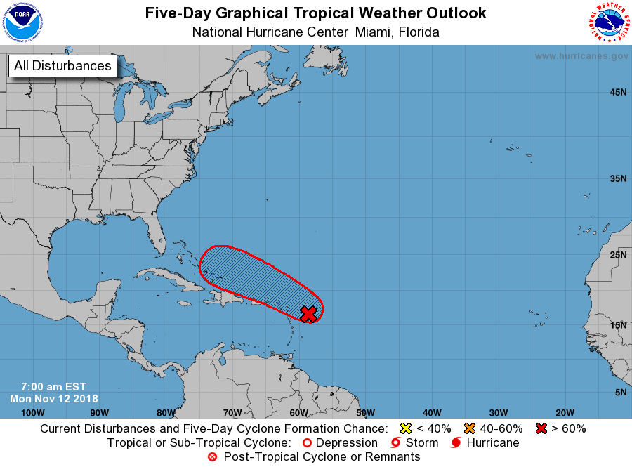
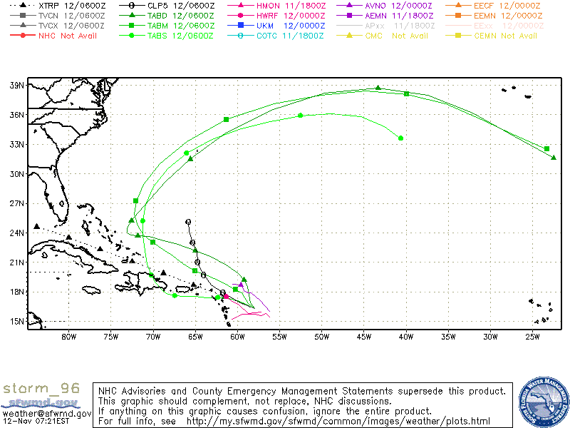
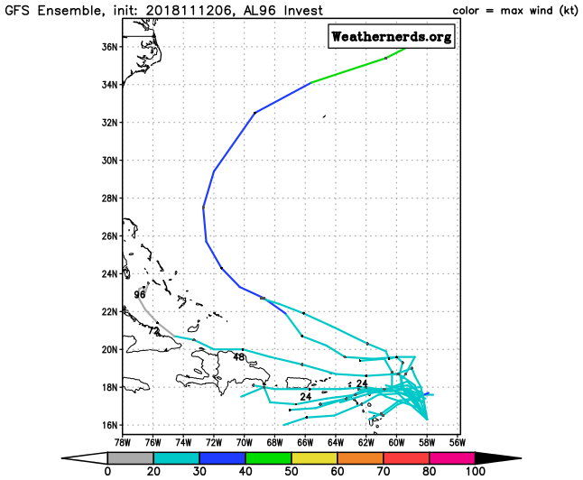
1. A vigorous tropical wave located about 200 miles east of the Leeward
Islands is producing a large area of disturbed weather over much of
the western tropical Atlantic Ocean. Shower and thunderstorm
activity has increased and become a little more concentrated this
 morning, and environmental conditions are forecast to gradually
become more conducive for the development of a tropical depression
or a tropical storm during the next day or so. The disturbance is
forecast to move westward to west-northwestward for the next few
days, passing near or north of the Leeward Islands, Puerto Rico,
Hispaniola, and the southeastern Bahamas. Interests in these areas
should closely monitor the progress of this system.
* Formation chance through 48 hours…medium…50 percent.
* Formation chance through 5 days…high…90 percent.
Additional information on this system can be found in High Seas
Forecasts issued by the National Weather Service, under AWIPS header
NFDHSFAT1, WMO header FZNT01 KWBC, and available on the Web at
https://ocean.weather.gov/shtml/NFDHSFAT1.shtml.
Forecaster Stewart
 Tropical Weather Outlook
NWS National Hurricane Center Miami FL
400 AM PST Mon Nov 12 2018
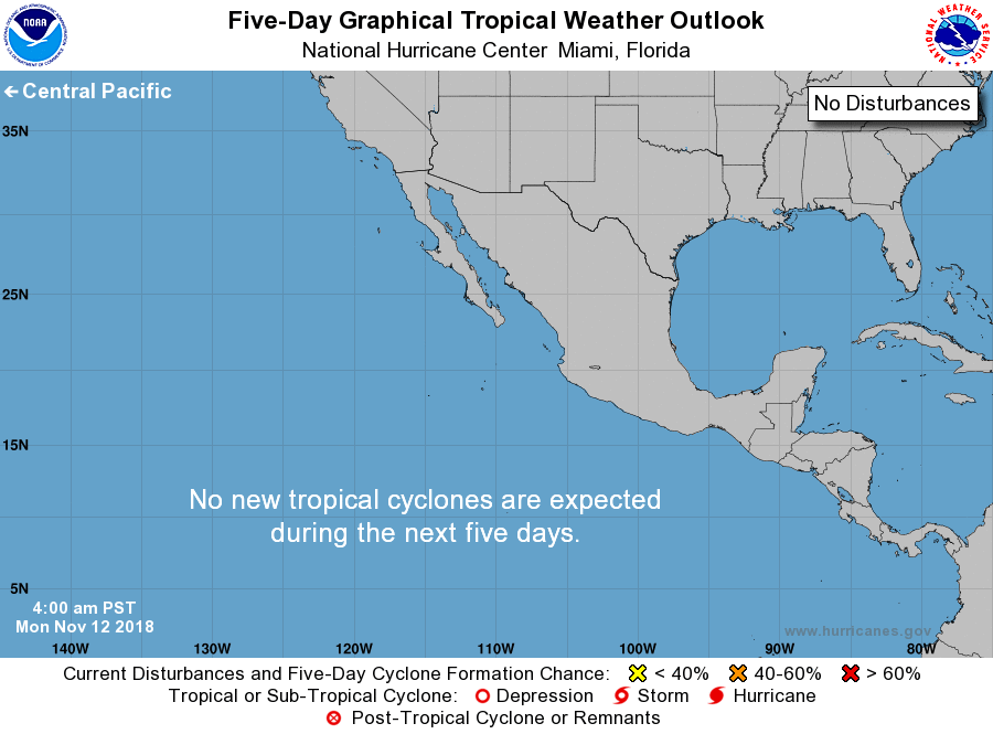
For the eastern North Pacific…east of 140 degrees west longitude:
Tropical cyclone formation is not expected during the next 5 days.
$$
Forecaster Stewart
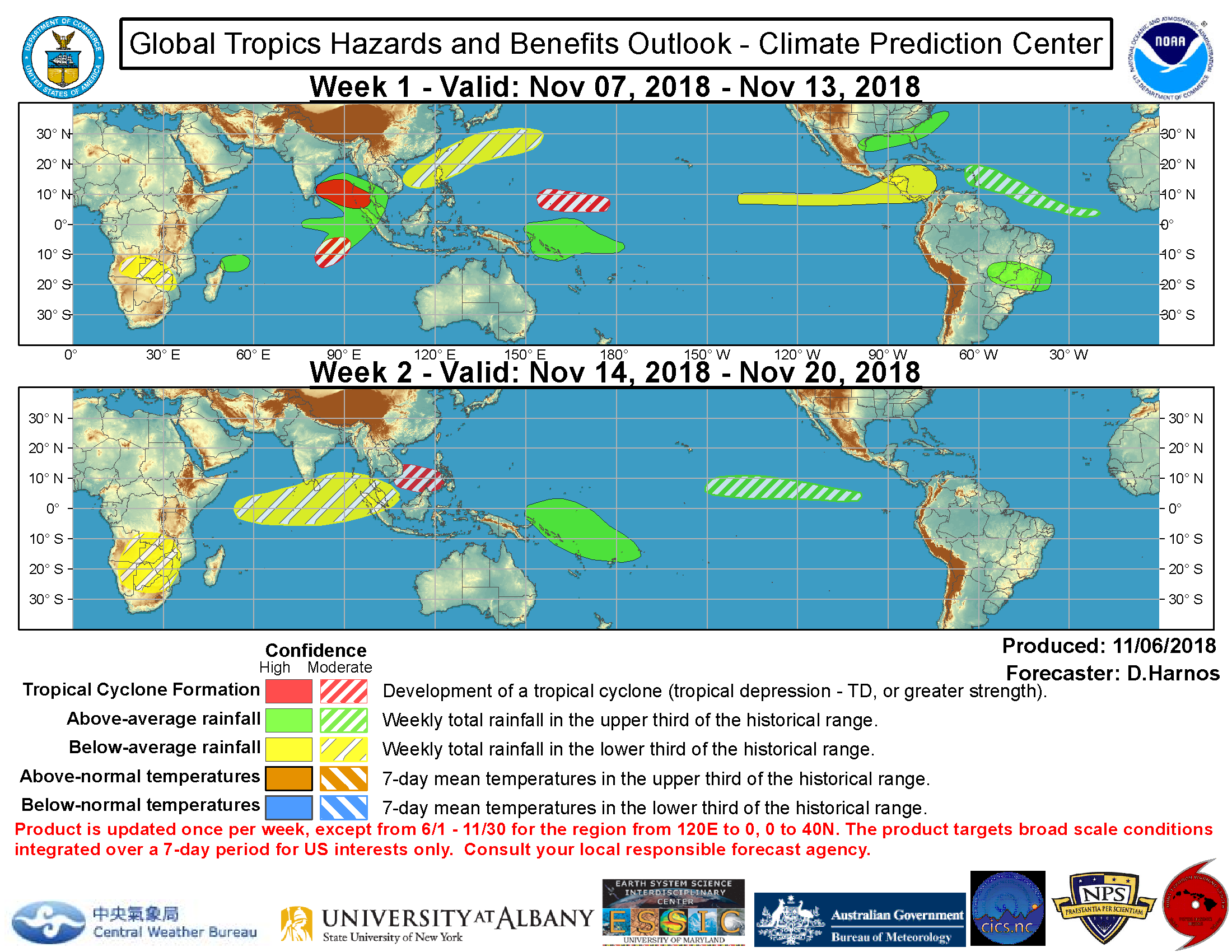
Global Tropics & Benefits Outlook
Weather in Cayman
SYNOPSIS
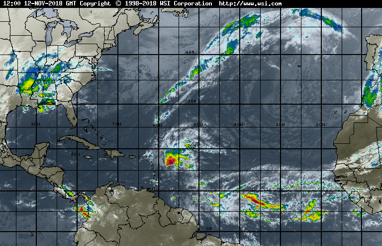
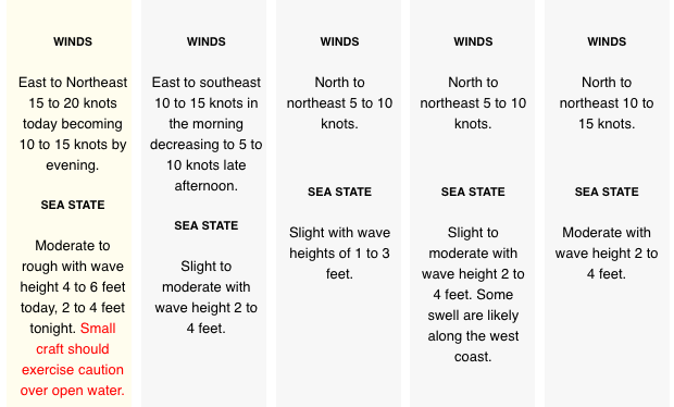
Moderate to fresh northeasterly winds and rough seas are expected over the next 12 hours as a ridge of high pressure moves the western Atlantic Ocean. Radar images show isolated showers over the Cayman area moving towards the west.
Humidity: 79% (DOWN from yesterday)
UV: 8.4 VERY HIGH (DOWN from yesterday)
Temperature: Today’s current temperature – See weather forecast top right of website. Yesterday: H 86.5°F L 77.0°F
Wind direction TODAY: N 15-25 mph GC
Wind direction TONIGHT: E 10-20 mph GC
Barometer: 1015.60 mb Steady Rain: Last month: 2.39 in Last 24 hrs 0.05 This month: 1.30 in 0 days since rain 6 rain days in November
2017 Season Total: 62.94 in 2018 Season Total: 39.91 in
Average Yearly Rainfall 56.20 in (Note: National Weather Service 2017 Season Total – measured at Owen Roberts Airport GT – was 59.32 in)
All readings are from SOUTH SOUND.
Average rainfall in November 4.6 in. Average temperature in November: 75°F to 86°F
Sea Temperature in November: 82°F
MOON:

22%Waxing Crescent
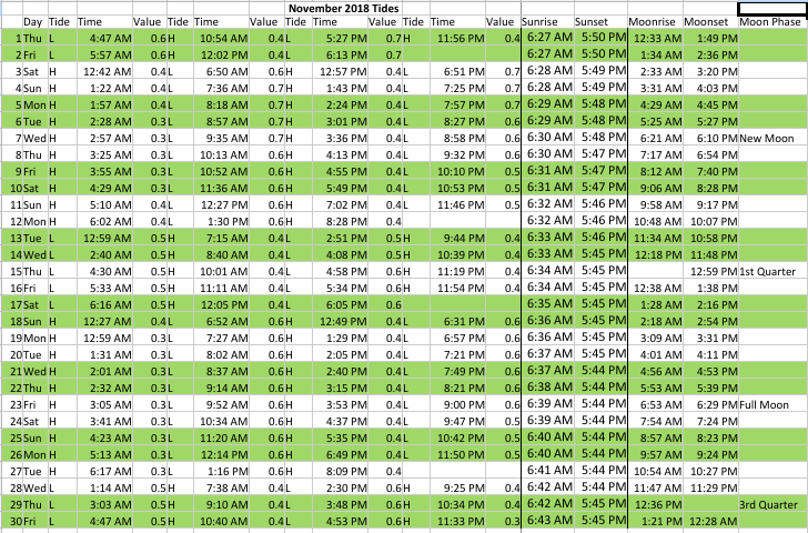
TIDES, SUNRISE, SUNSET, MOON RISE, MOON SET AND MOON PHASE
GRAND CAYMAN November 2018 – Click to enlarge
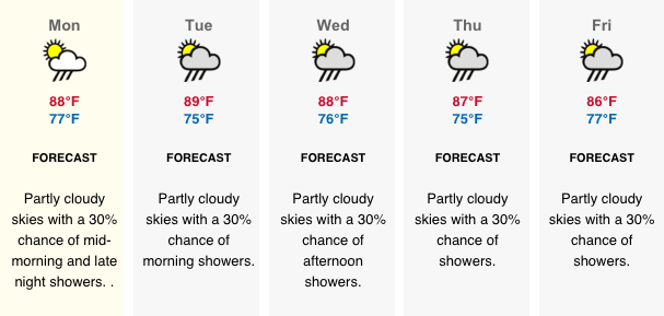
LOCAL 5 DAY FORECAST
http://www.weather.gov.ky/portal/page?_pageid=4421,7428393&_dad=portal&_schema=PORTAL
FOR RADAR IMAGE GO TO: http://www.weather.gov.ky/portal/page/portal/nwshome/forecasthome/radar
Also see Weather In Cayman: http://www.weatherincayman.com/
Moon info and graphic:
https://www.timeanddate.com/moon/uk/georgetown
Atlantic satellite image: http://www.intellicast.com/global/satellite/infrared.aspx?region=hiatlsat
Description:
The Global Infrared Satellite image shows clouds by their temperature. Red and blue areas indicate cold (high) cloud tops. Infrared (IR) radiation is electromagnetic radiation whose wavelength is longer than that of visible light, but shorter than that of terahertz radiation and microwaves. Weather satellites equipped with scanning radiometers produce thermal or infrared images which can then enable a trained analyst to determine cloud heights and types, to calculate land and surface water temperatures, and to locate ocean surface features.
Tropical storm data and graphics from National Hurricane Center at: https://www.nhc.noaa.gov/
Weathernerds: https://www.weathernerds.org/


1 COMMENTS